Frequently Asked Questions (FAQs)
1. What is CAMALIOT?
CAMALIOT is a project funded by the European Space Agency to build the infrastructure for ingesting large volumes of observations from various kinds of GPS-capable receivers. The data are then combined with other sources of data using machine learning for applications like weather forecasting. With the proliferation of smartphones, wearables and the Internet of Things (IoT), observations acquired from such devices will become the next big data source. Therefore, the CAMALIOT project is laying the groundwork for exploiting this rapidly increasing source of data.
By collecting data through the CAMALIOT mobile app, you are helping us not only to improve weather forecasting and the general understanding of weather phenomena, but also to investigate new scientific opportunities that could benefit society in the future.
There are also potential benefits for improving the locational accuracy of the GPS in our mobile phones, which is currently on the order of several metres. For example, you may have noticed that when you navigate in built-up areas using your mobile phone, interference from tall buildings and trees can result in a decreased accuracy of the GPS, and often misleading location information.
2. What is GNSS and how is this related to GPS?
GNSS refers to the Global Navigation Satellite System, which is a set of satellites in outer space that continually transmit radio signals with encoded information on their location in space and in time. These data are then used to calculate locations of GPS receivers on Earth for purposes such as navigation. For example, smartphones have a GNSS receiver, which we often refer to as the GPS. The latter is simply one component of the GNSS that is maintained by the US government.
Click here if you want to learn more about GNSS.
The GNSS data received by your smartphone are then used in applications such as Google Maps, e.g., to find nearby points of interest or navigate you to a destination. The data are also used in one of many other location-based service apps on your phone.
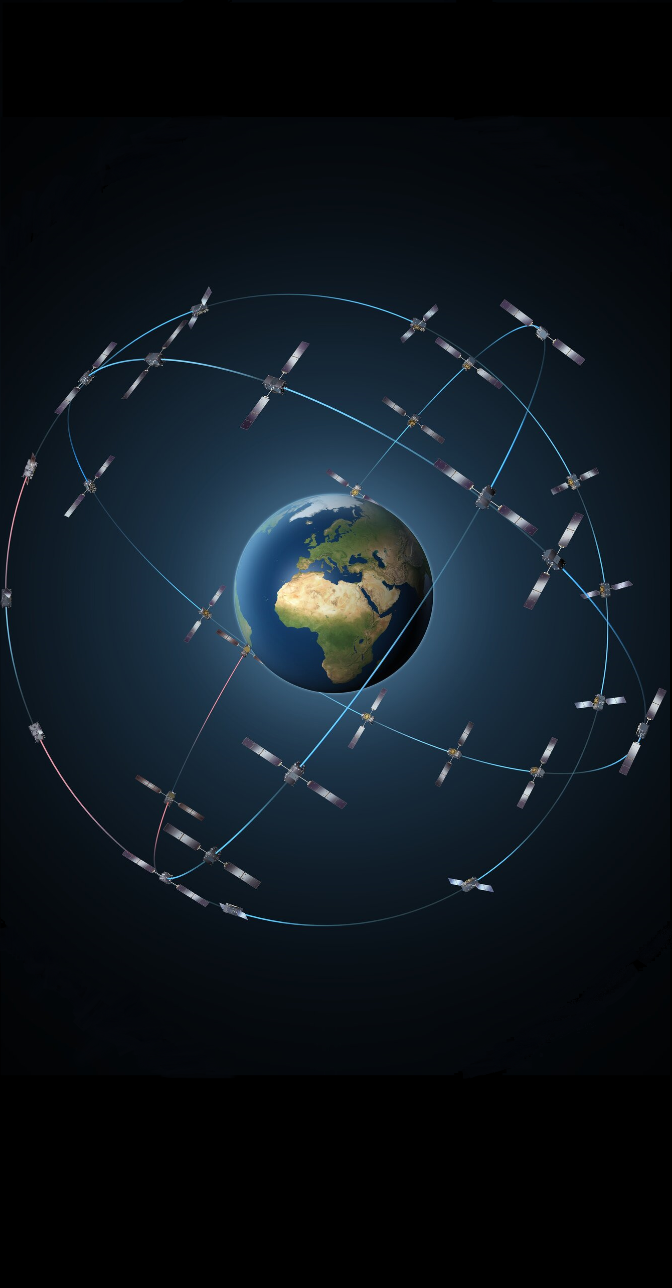
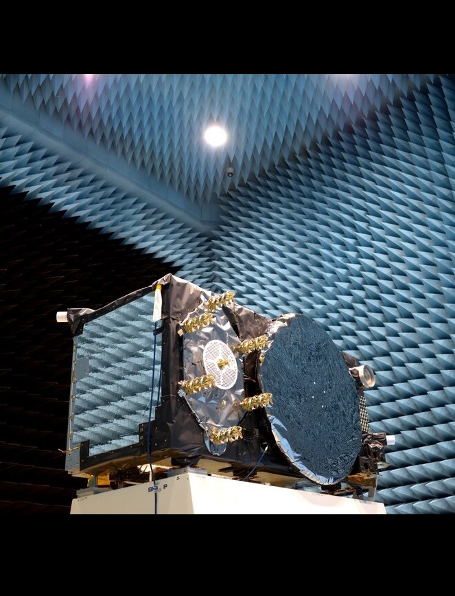
3. What satellites are in the GNSS?
The GNSS comprises four main global constellations of satellites operated by different countries. The GPS (or the Global Positioning System), which is operated by the US Space Force, is one part of the GNSS and has a constellation of 31 satellites.
Two further regional constellations are operated by Japan and India, with 12 satellites in total. Together the GNSS provides the information needed to pinpoint locations of various GNSS receivers on Earth.
GLONASS is operated by the Russian government with 24 satellites, Galileo is an initiative from the European Union with 26 satellites, and BeiDou, operated by the China National Space Administration has 48 satellites.
4. How does my mobile phone receive data from GNSS satellites?
Most smartphones have a built-in GNSS receiver, which can calculate its position based on observations of signals transmitted by at least four visible satellites. Most smartphone GNSS receivers are single frequency, which means they can obtain information transmitted within a certain set of wavelengths (from 1.1-1.6 GHz). Using this single-frequency information from at least four satellites to pinpoint the location will result in a spatial accuracy of around 10 m on average for most smartphones. Of course, the more satellites that are used to derive the position, the better the position estimates will be.
Accessing this raw GNSS data has also been made possible through the development of application interfaces in newer versions of the Android operating system, released since 2017. The CAMALIOT app uses these application interfaces to collect and extract the raw GNSS data received by a smartphone. Hence, the app only operates on Android version 7 or later, but it can collect the raw GNSS data from Android phones that have either single-frequency or dual-frequency receivers.
However, some newer models of Android phones are equipped with dual-frequency GNSS receivers; see the list of available phones here . This means that these smartphone models can receive additional information from the GNSS satellites across a wider set of frequencies, where this added information can produce a higher positional accuracy.
5. What kinds of data are collected by the CAMALIOT app?
The CAMALIOT app collects raw GNSS data that are transmitted from orbiting GNSS satellites, which, among others, includes the following:
- signal strength of the observed satellites
- distances to the observed satellites
- carrier phase and the number of carrier phase cycles (per satellite).
If you want to know more about what a carrier phase is or data from satellites, click here.
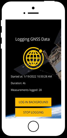
When you start logging with the CAMALIOT app, it extracts and stores this information on your phone. When you upload the data to the CAMALIOT server, these data streams are then used to feed the machine learning algorithms for space and atmospheric weather prediction. Note that no personal information such as usernames or emails are stored with the GNSS data so it is impossible to identify a person.
6. How can GNSS data from smartphones improve weather forecasting?
GNSS serves as an important tool in the area of atmospheric research due to its all-weather capability and spatio-temporal resolution of the estimates that this technique can provide. A large number of observations collected at various parts of the globe and the sensitivity of the GNSS technique to changes of ionospheric and tropospheric states allow the phenomena driving changes in those domains to be quantified.
This is reflected in the observed variations in total electron content (TEC) or water vapor content, where the latter is deduced based upon the information contained in the zenith wet delays and tropospheric gradients, both set up as solve-for parameters in the GNSS data analysis.
Zenith wet delay (ZWD) and tropospheric gradients, obtained as a result of GNSS parameter estimation, are a function of atmospheric water vapor and temperature. Thus, precipitable water vapour (PWV) overlying the receiver can be determined from the derived ZWD time series if certain constants related to the refractivity of moist air and of the weighted mean temperature of the atmosphere are known. Thanks to continuously operational GNSS, long-term PWV trends can be acquired globally. By assimilating derived water vapour content into the numerical weather models, one can use that knowledge in weather forecasting.
7. What is machine learning and how does it work?
Machine learning is part of the field of Artificial Intelligence (AI) in which algorithms (or a set of instructions coded as a computer program) are trained to learn relationships found in a data set. This is sometimes also called data mining. Some of these machine learning algorithms are loosely based on the way in which our brains function, which is why they are referred to as AI.
One of the earliest examples of a machine learning algorithm was used by IBM to beat a grand master at playing the game of checkers, while more recently, IBM’s Watson has learned to play the game of Jeopardy. Machine learning is now part of many applications from optimizing your heating system based on your behaviour and the outside temperature to computer vision in facial, fingerprint and licence plate recognition.
For example, the set of algorithms referred to as neural networks are simplifications of the way that neurons function in our brain to learn new skills. By providing a ‘training’ data set of examples to a machine learning algorithm, it can learn the relationships that are present in the data. Then once it’s trained, it can be used to make predictions, e.g., will a stock go up or down in the stock market, or to classify objects automatically, e.g., instant recognition of faces from a photograph. These algorithms can also learn over time and in that way improve their predictions and classifications as they are fed more data.
8. How is machine learning used in CAMALIOT?
ML-enabled processing in relation to the CAMALIOT project allows us to combine different data types from various sources such as permanent geodetic GNSS stations, spaceborne data, auxiliary parameters related to the ionospheric state to the large volumes of smartphone-based GNSS observations potentially collected continuously or in near-real-time.
The goal of this project is troposphere/ionosphere modelling and forecasting of troposphere-related and ionosphere-related based on the data fusion of GNSS observations (raw GNSS data from the CAMALIOT mobile app and GNSS data from geodetic stations) with other sources of valuable information, all performed with the use of machine learning.

Exploiting machine learning and its capability to learn from large amounts of heterogeneous datasets can be useful for capturing complex ionosphere-related phenomena as well as predicting other parameters that describe the Sun-Earth interactions. Machine learning methods in this context also allow heterogeneous datasets related to the atmosphere to be combined in an optimal fashion while reducing space-variant biases. Similar to ionospheric modelling, machine learning can be used as a method for improving tropospheric corrections at a large scale, reduce local biases and avoid error-prone interpolation methods while not imposing any comprehensive constraints.
9. How can GNSS data be used to improve GPS accuracy?
Ionospheric disturbances negatively affect the positional accuracy of single-frequency GNSS-capable devices, like most smartphones. In order to overcome this, users need external information to correct the ionospheric signal delay, e.g., by using external ionospheric models. Global empirical ionospheric models already exist that allow the signal delay to be predicted in the form of the total electron content (TEC). TEC is a function of many variables, including long and short-term changes in the solar ionizing flux, magnetic activity, the season, the time of day, the location and the viewing direction.
Obtaining VTEC with higher precision, better spatial and temporal resolution and taking rapid disturbances such as geomagnetic storms into account is one of the objectives of the CAMALIOT project. In addition to improving space weather forecasting, the models can also be used to improve the estimates of the position of the GNSS receiver.
TEC parameters are estimated from rudimentary assumptions and mapping functions that relate slant TEC observations to TEC in the vertical direction, hereafter referred to as VTEC. However, accurate ionospheric forecasts are limited, to a large extent, by the disturbances induced by geomagnetic storms or other rapid events. Such phenomena cannot be easily accounted for in conventional prediction models.
10. Can I use the data collected in the CAMALIOT project for research?
Yes, you can use the app to collect data at your location and download it in RINEX3 format. Click on the cloud icon at the bottom of the app. This allows you to download data from individual logging sessions.
In the future, you will be able to access the data collected by others from the GSSC portal .
11. How do I access the data that I collected using the CAMALIOT app?
Go to the upload page in the CAMALIOT app and click the “Convert to RINEX” button for the logging session you want to access. After the logged file has been converted into the RINEX file format, a message box appears with the path in which the RINEX file has been stored. You can now use a tool like X-plore which is available on the Google Play Store here (https://play.google.com/store/apps/details?id=com.lonelycatgames.Xplore&hl=en&gl=US) to access the file. Please note when you use the X-plore app the first time, you need to give it privileges to access files on your phone.